
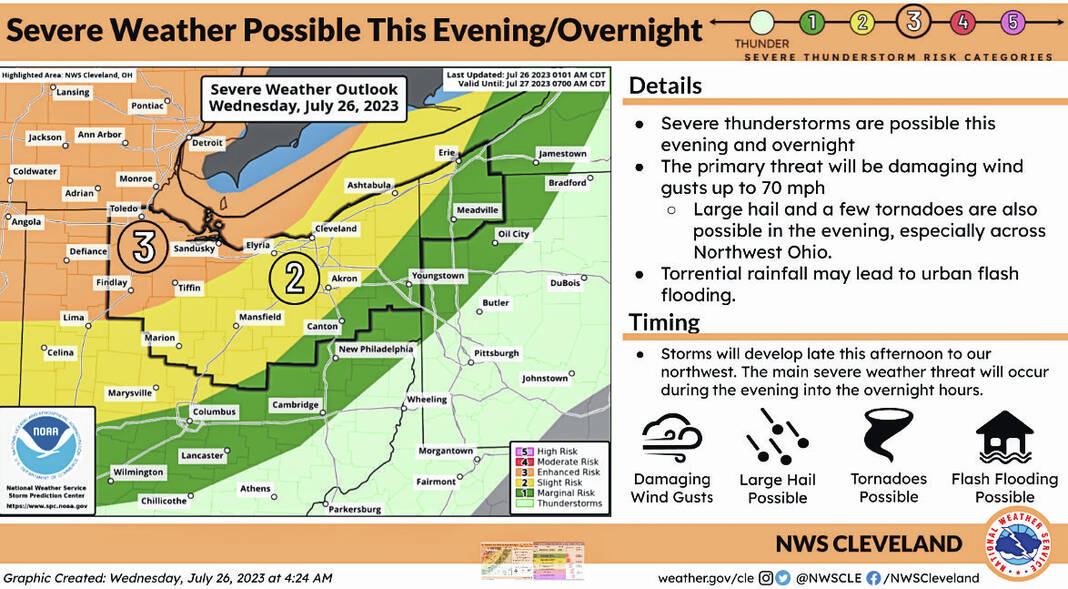
The threat of severe weather remains in the “enhanced” risk (level 3 of 5) for all of northern Ohio, according to a Wednesday morning update by the Wood County Emergency Management Agency.
It is expected for storms to begin forming around 1-4 p.m.; 8 p.m.-2 a.m. will be the anticipated timeframe for the strongest thunderstorms.
Expected wind speeds have increased to 70 mph and large (golf ball sized) hail is an increasing concern. Wood County is also under a “marginal” risk for excessive rainfall which could bring torrential rainfall at times and is estimated to total about an inch.
If possible, the agency is recommending not being outside and/or driving during these storms unless necessary. If you will be exposed to the elements out of necessity, have a plan for action should the conditions become threatening or deteriorate.
Take the following steps to prepare:
Have multiple ways to get emergency notifications: Register for CodeRED Wood County’s Mass Notification System, purchase or turn on your NOAA Weather Radio, download your preferred phone apps, and tune in to local media.
The link to sign up for CodeRED: https://public.coderedweb.com/CNE/en-US/BFAB7B074BCD
Have flashlights (with working batteries) accessible in sleeping areas should the power go out.
Have a location pre-determined where you can seek shelter should the need arise.
Secure any loose outdoor items or bring them indoors prior to.
As always, with the potential for high winds, tree damage as well as utility disruption can be expected and should be prepared for.
The EMA will be monitoring and will provide updates as appropriate.
