
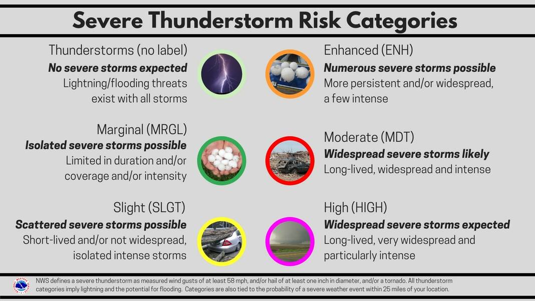
Wood County remains under a slight risk for severe weather this evening and into tonight. While area of slight risk has expanded, the confidence of severe weather has decreased. However, isolated severe weather continues to remain a possibility.
Jeff Klein, director of Wood County Emergency Management Agency, reports dry and warm conditions are likely through the rest of the day with highs around 70. Southerly winds will increase to 15 mph with gusts to 25 mph this afternoon.
Scattered showers and thunderstorms will develop later tonight ahead of a cold front. These storms are expected to have brief heavy downpours and moderate amounts of lightning. There is an isolated threat of marginally severe wind gusts to 50 mph and hail in tonight’s storms.
Showers are expected to end by 8-9 a.m. tomorrow with some light snow possible as temperatures drastically drop behind a cold front. No snow accumulation is expected. Winds will increase tomorrow to 25 mph with gusts to 40 mph are possible.
