
Wood County remains at an “elevated risk” for storms on Wednesday, according to a Tuesday afternoon update by the Emergency Management Agency.
The severe weather is still on track.
There is the possibility thunderstorms Tuesday evening, but nothing of significance is expected.
The variable NWS is working with will be the cloud cover during the day on Wednesday. If it is cloudy during the morning hours, it will reduce the impact to Wood County.
“We are still expecting multiple rounds during the day. The greatest concern will be when the front moves through in the evening. This front has the potential to have large hail (2 inches or greater), 70 mph winds, and we are in the area of risk for EF2 tornadoes or greater,” according to the EMA.
This storm is currently in Iowa and producing 2-inch hail, 70-80 mph winds and structural collapse of several buildings.
“It is important to note, the information we are being provided is that this is a very rare event and is the first time we have seen this in several years. The tornado threat is a high probability,” the EMA stated.
Common preparedness steps:
· Have multiple ways to get emergency notifications.
· Keep cell phones charged with backup batteries.
· Have a family communications plan.
· Make sure you have flashlights with spare batteries.
· Prepare for extended power outages.
The next update will be at 8am and we will provide you an update off that. NWS Cleveland will also have a Facebook live tomorrow at 11am. I would encourage you to attend if you have the opportunity.
I hope that we will have good news tomorrow, and the cloud cover will stick around after tonight’s storms. All indications up to this point agree that there will be severe to extreme weather in NW Ohio.
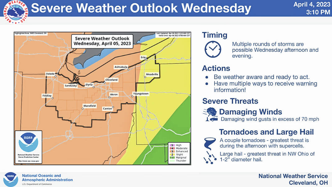
Showers and thunderstorms are expected to develop on Wednesday afternoon and evening. There could be two rounds of storms — one well ahead of a cold front in the afternoon and another during the evening closer to the front.
Storms have the potential to become severe with all severe hazards possible, including damaging winds, tornadoes, and hail
Non-thunderstorm wind gusts will be strong once again on Wednesday with southerly wind gusts in excess of 40 mph possible.
Uncertainty remains in the forecast. The degree of cloud cover and showers during the first half of the day may impact strength and coverage of storms in the afternoon.
