
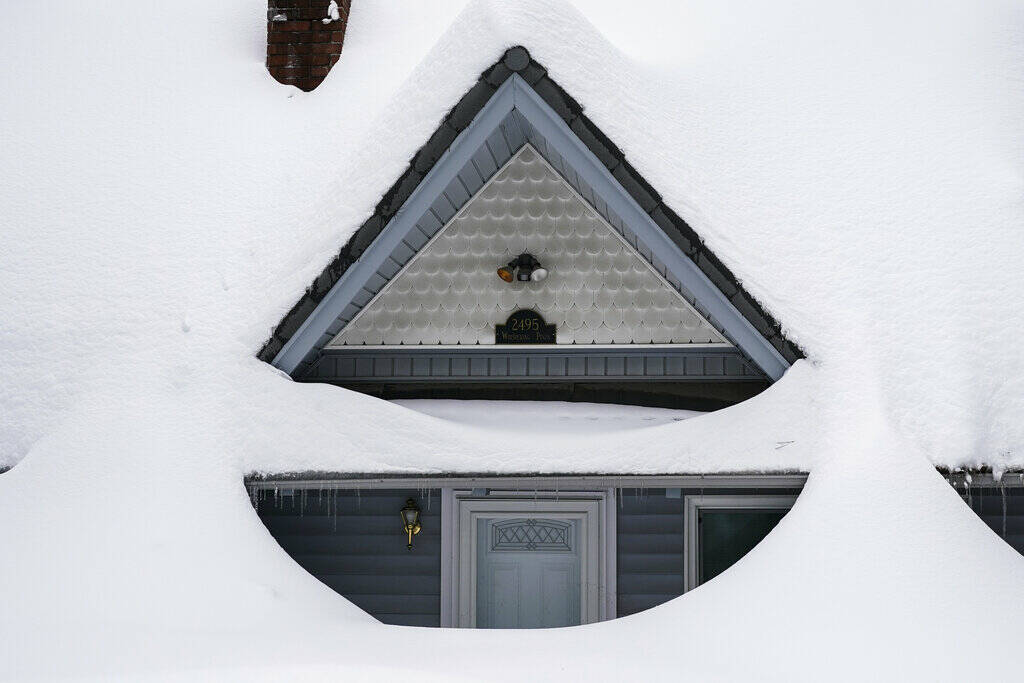
Snow is piled up on a home in Running Springs, Calif., Tuesday, Feb. 28, 2023. Beleaguered Californians got hit again Tuesday as a new winter storm moved into the already drenched and snow-plastered state, with blizzard warnings blanketing the Sierra Nevada and forecasters warning residents that any travel was dangerous. (AP Photo/Jae C. Hong)
LOS ANGELES (AP) — California’s latest winter storm was tapering off early Wednesday, but dangerous conditions persisted, including widespread freezing as skies cleared in the north.
In the Sierra Nevada in Northern California, where blizzard warnings were issued overnight and into early Wednesday, major highways were subject to closures and chain restrictions, and authorities warned of high avalanche danger at all elevations of the backcountry.
In Southern California, snow and ice forced closure of Interstate 5 in Tejon Pass through mountains north of Los Angeles.
Visitors to mountains in southern California were stranded for days and thousands of homes and businesses were in the cold without electricity as the storm also dumped rain in some areas and chilled much of the state.
The heavy snow was expected to end Wednesday afternoon after an additional 1 to 2 feet (30 to 60 centimeters) falls in the region, according to the National Weather Service.
The University of California, Berkeley Central Sierra Snow Laboratory near Donner Pass reported that nearly 41.7 feet (12.7 meters) has fallen since October, more than in any snow year since 1970 and second only to the record of 66.7 feet (20.3 meters) in 1952.
Mammoth Lakes, traditionally one of the snowiest places in California, had nearly 4 feet (1.2 meters) of snow over the past three days. Snow drifts were taller than houses, and crews worked around the clock to keep roads and sidewalks clear.
Homeless people and those without electricity were at special risk from the cold, the weather service said.
The storm comes a week after storms stretched from the Pacific Coast to the northern Plains and is now blamed for two deaths in Portland, Oregon. One of them died of hypothermia on Tuesday, according to a medical examiner.
The weather service predicted that a powerful weather system would affect most of the lower 48 states into Thursday, with heavy snow across the Southwest and some portions of the high Plains, but also record high temperatures in the Gulf Coast into the Ohio Valley and a threat of tornadoes from the southern Plains to the mid-South.
“The system is going to be moving generally east-northeast and fairly fast, so it’s going to cross the country in a few days,” said meteorologist David Roth. Six to 12 inches (15 to 30 centimeters) of snow could eventually fall in upstate New York, Vermont and New Hampshire, Roth said.
Areas in the dividing line between hot and cold, such as the lower Mississippi Valley and Tennessee Valley, could see heavy rain, thunderstorms and some flash flooding. The high could top 100 degrees (38 Celsius) across far south Texas, and windy, dry conditions would make for a critical risk of wildfire conditions across in parts of the Southwest for the next few days, according to the weather service.
Recent storms around the country have delayed travel, shuttered schools and overwhelmed crews trying to dig out of the snow and repair downed power lines. More than 62,000 customers were without power Wednesday morning in Michigan, which is still recovering from ice storms, and nearly 110,000 in California, according to the website poweroutage.us.
In Arizona, snow began falling Wednesday morning from a storm that was expected to dump 18 inches to 2 feet of snow in northern areas of the state by Thursday morning, the weather service said.
Many schools in the Flagstaff area closed ahead of the system.
The weather service said Flagstaff received nearly 33 inches of snow in February, just shy of double the city’s annual average of 18.6 inches for the month, and has already received 118 inches of snow this year, topping the annual average of 90.1 inches, with 10 months of the year remaining.
Weather also continued to play a role in the cancellation of nearly 100 flights and delays of nearly 1,000 more around the country.
In California’s Sierra Nevada, the weather service warned that travel could be difficult to impossible because blowing snow could cause whiteouts on roads, while wind chill factors as low as minus 30 (minus 34 Celsius) could quickly cause frostbite.
The Lake Tahoe area that straddles the California and Nevada borders in the Sierra Nevada was expected to have blizzard conditions with winds gusting to 100 mph along the ridgetops, while the lake itself could see waves large enough to capsize small boats, the weather service warned.
“If you risk travel you could become stranded in vehicles for hours,” the weather service warned.
Yosemite National Park, closed since Saturday because of heavy, blinding snow, postponed its planned Thursday reopening indefinitely.
The Sierra snowpack provides about a third of the state’s water supply and the water content of the snowpack Tuesday — in a state grappling with years of drought — was 186% of normal to date. It was 162% of the average on April 1, when it is historically at its peak, according to the state Department of Water Resources’ online data.
___
Associated Press writer Walter Berry in Arizona in contributed to this report.
